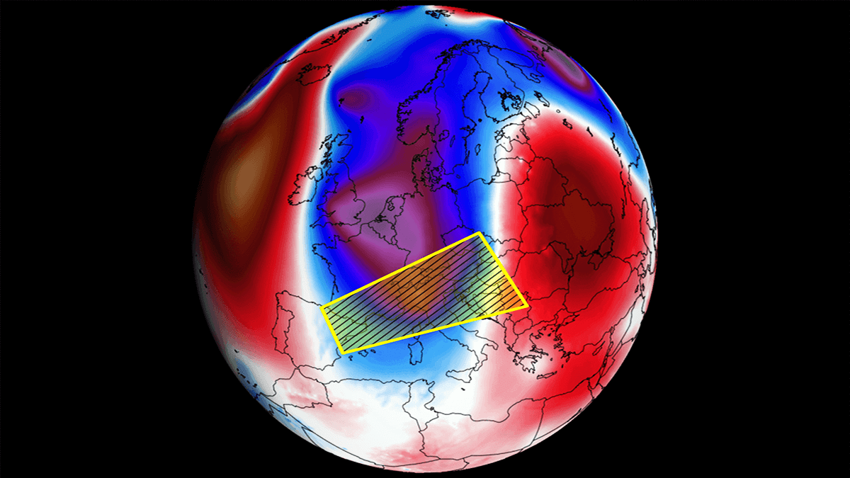
A deep trough formed from the ex-hurricane Erin has established over western Europe and is gradually drifting east and south in the coming days. This will establish a widespread multi-day severe weather outbreak for central Europe and the northern Mediterranean, where volatile environmental conditions combine. Severe thunderstorms will support damaging winds, large hail, a few tornadoes, and excessive rainfall with a flooding threat, prompting a high-risk event for the region.
After the overheating period over Europe, the weather pattern has become more dynamic recently. And the final days of the meteorological summer 2025 will bring a widespread active severe weather period.
From Wednesday night through Saturday, multiple rounds of severe thunderstorms are forecast from northeast Spain across southern France to Switzerland, north-central Italy, the Alpine region, the Adriatic region, and the northern and western Balkan peninsula.


The background process leading to the robust pattern dynamic for the end of summer lies in the mid-latitude cyclone originating from the ex-hurricane Erin in the North Atlantic. Hurricane Erin was the first Category 5 storm of the season, then made a spectacular transition into a post-tropical storm when approaching western Europe last Sunday.
The following image represents a water vapor satellite image of ex-Erin on Sunday evening. A mesmerizing cyclonic structure was completed after the transition into a post-tropical storm. The system remained a powerful storm and led to the rapid deepening of the upper cold wave, which is our feature of interest in the discussion.
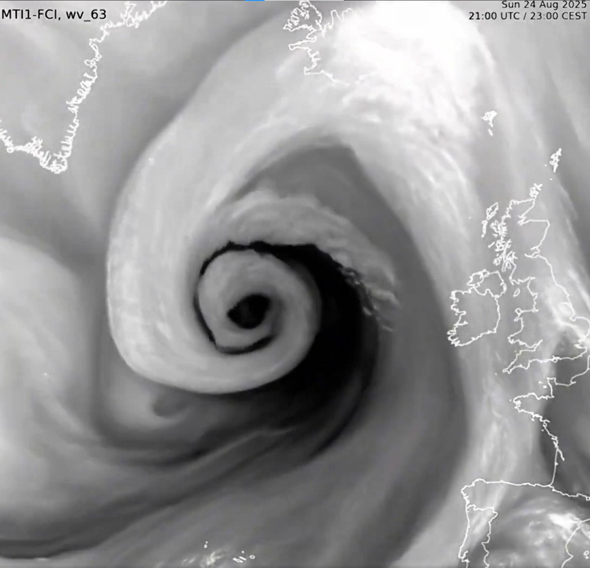

Since the low has a tropical origin, it often means the air masses support more robust environments than the classic North Atlantic and mid-latitude lows. Therefore, the potential impact of the upper trough grazing on the European continent is significant.
The quick overview video for the remainder of August 2025 indicates the trough digging from western Europe into the central parts of the continent, inducing a multi-day severe weather outbreak with numerous thunderstorms and intense rainfall events across the Alpine region and the north-central Mediterranean.
With the environmental conditions improving and becoming more robust after today, the severe weather threat will first increase over northeast Spain into southern France on Wednesday night, then spread into the Alpine region with a widespread severe weather outbreak on Thursday.
This will be followed by additional widespread severe weather further east and south on Friday and Saturday. While the main threat will be extreme rainfall and potential flooding, intense supercell thunderstorms with large hail, severe winds, and tornadoes will also form.
A deep trough emerges over central Europe
The fully matured trough over western Europe is now gradually expanding east and south and is forecast to be considerably deep from Thursday to Friday. This will establish a typical volatile setup for the north Mediterranean and the Alpine region.
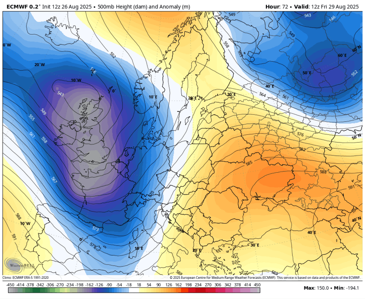

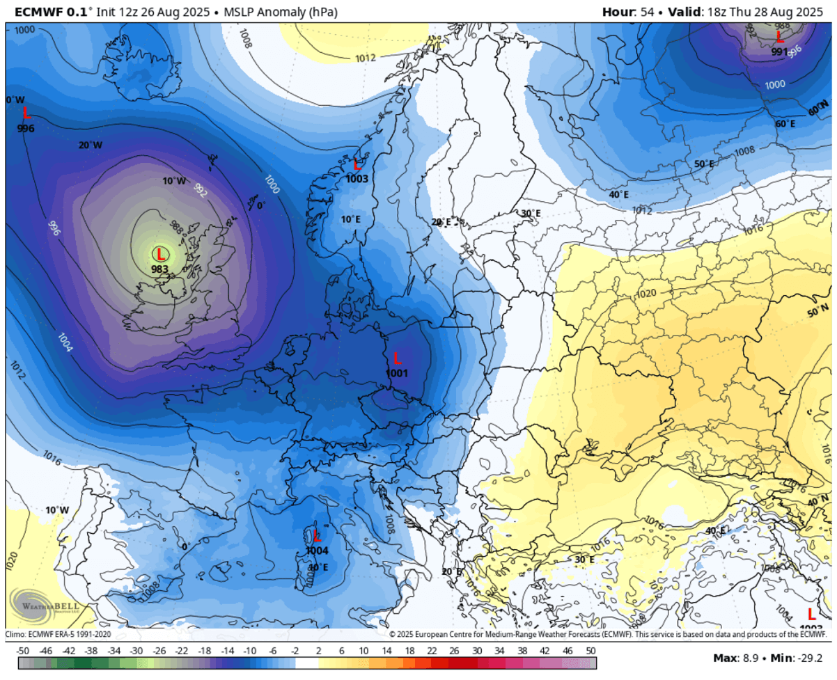
At the surface, an extensive low-pressure system remains over Ireland and the UK, with a secondary low forming in the Mediterranean in response to the upper wave moving into the region aloft.
This is an essential factor for the region, as it also amplifies the low-level flow from the south towards northern Italy, enhancing moisture and instability. Therefore, it increases energy to fuel the frontal system and intensifies it.

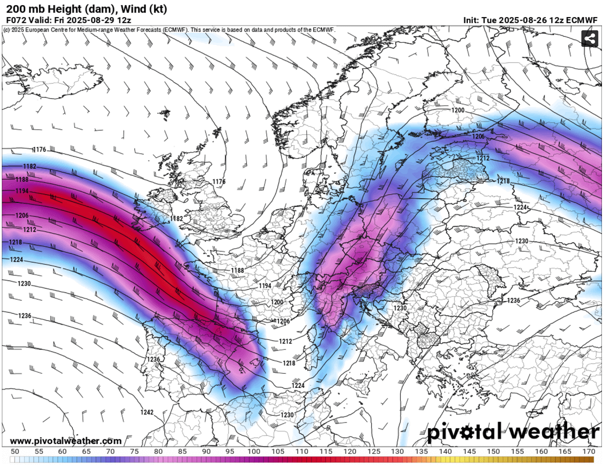
With the blocking High located to its east over southeastern Europe, the deep trough significantly amplifies the polar jet stream, thus providing powerful upper-level winds.
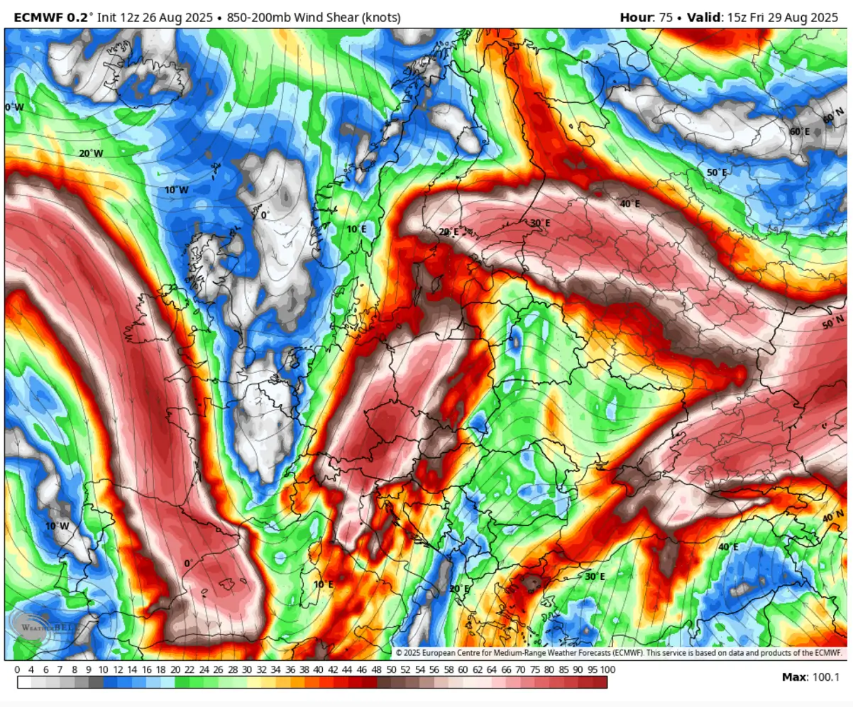
The following chart represents the 200 mbar geopotential height winds, with a textbook divergence supporting widespread forcing for the Northern Mediterranean. This leads to a very strong shear in place.

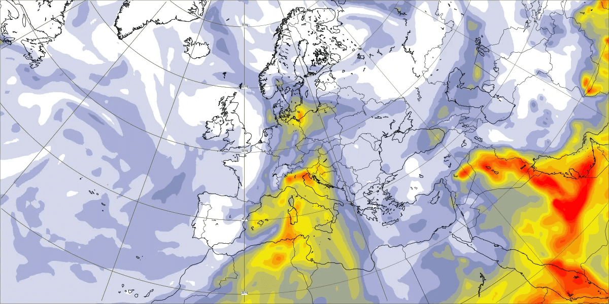
The intense jet stream winds also induce the Saharan dust cloud, which moves from Algeria and Tunisia into the Mediterranean and towards the Alps.
The dust deposits will be high on Thursday and Friday, thanks to persistent and strong southerly winds.

While the significant moisture recovery and widespread lifting support convective activity from northeast Spain and southern France to the western Alps this Wednesday, the much more robust environment follows on Thursday and continues into Friday and Saturday.
A multi-day severe weather outbreak for the northern Mediterranean, the Alps, and the western Balkans
Starting Wednesday night, the extensive trough from western Europe digs south enough to increase convective activity over the Alps and northern Italy, placed under the strengthening upper-level winds and building up instability.
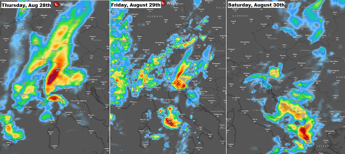
The following sequence indicates the approximate position of the main frontal activity over the next three days;
On Thursday, the activity develops over northern Italy, Switzerland, and western Austria, spreading east into the rest of Austria, Slovenia, western Croatia, and central Italy on Friday.
By Saturday, the frontal system moved further southeast, and the main activity reached southern Italy and the southwestern Balkans, with southern Croatia, Montenegro, and Albania under the most robust thunderstorms.

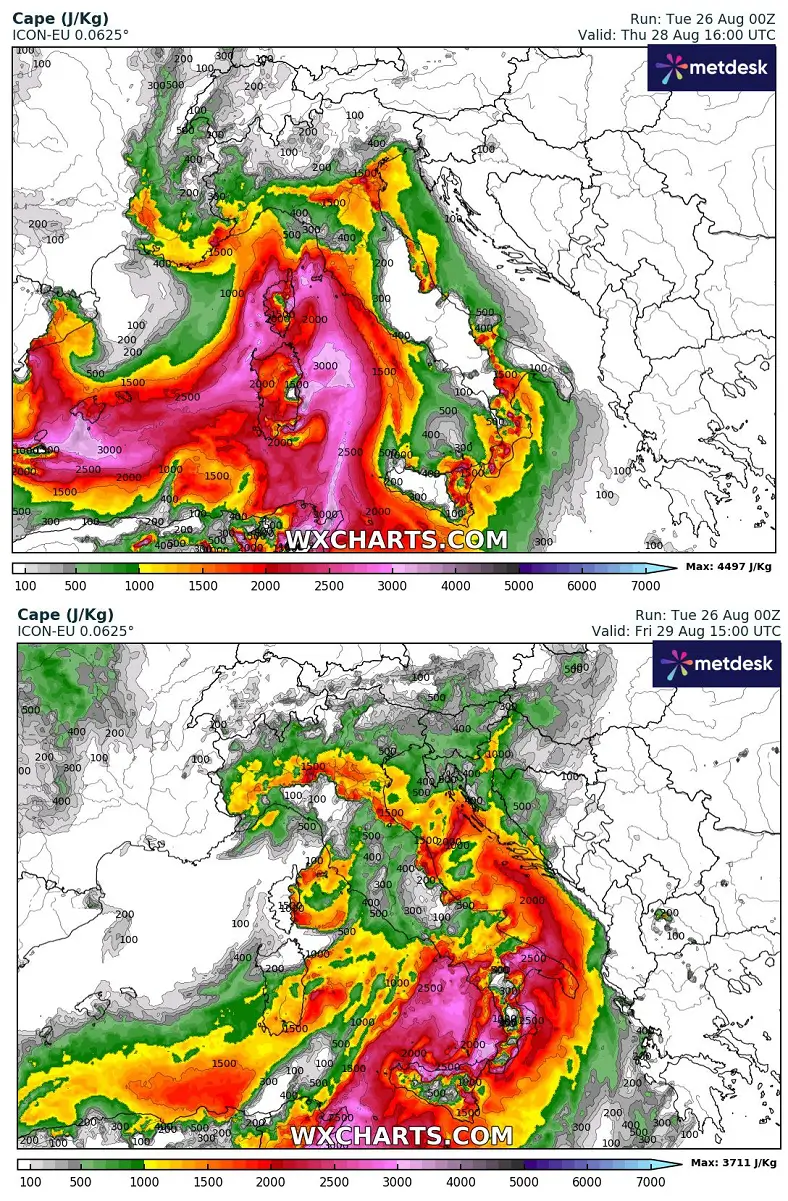
With the influence of the secondary low-pressure system forming in the Mediterranean on Thursday and the core of the upper trough slowly approaching, the instability quickly recovers over the north and central Italy, dragged from the Tyrrhenian Sea towards the Ligurian Bay.
On Friday, instability further increases over the Adriatic Sea and pushes towards the north.
Most weather models hint at the strong to locally extreme instability, in excess of 3000 J/kg in some places. This supports explosive storm development.

Thursday and Friday will provide powerful shear, meaning the environment will be conducive to organized storms across part of Italy, the southern Alpine flank, and across the Adriatic Sea into Slovenia and Croatia.
The left-exit region of the jet stream will provide a widespread vigorous thunderstorm development over Italy and the Alps on Thursday and over Slovenia and Croatia on Friday. This will include severe thunderstorms, including supercells with large hail, severe winds, tornadoes, and torrential rainfall.

As is typical in weather events like this one, the most concerning phenomenon will be the amount of rainfall, especially how intense and persistent the convective cells will be, and where.
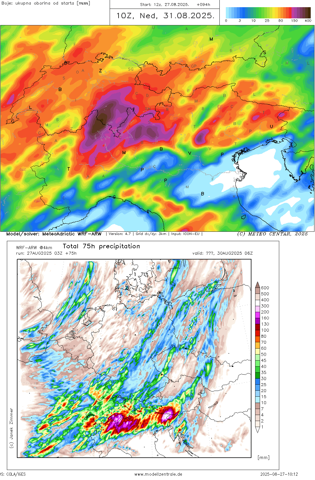
The weather models generally predict 100-200 mm of rainfall within 72 hours along the southern Alpine flank, the northern Apennines, and part of the western Balkans.
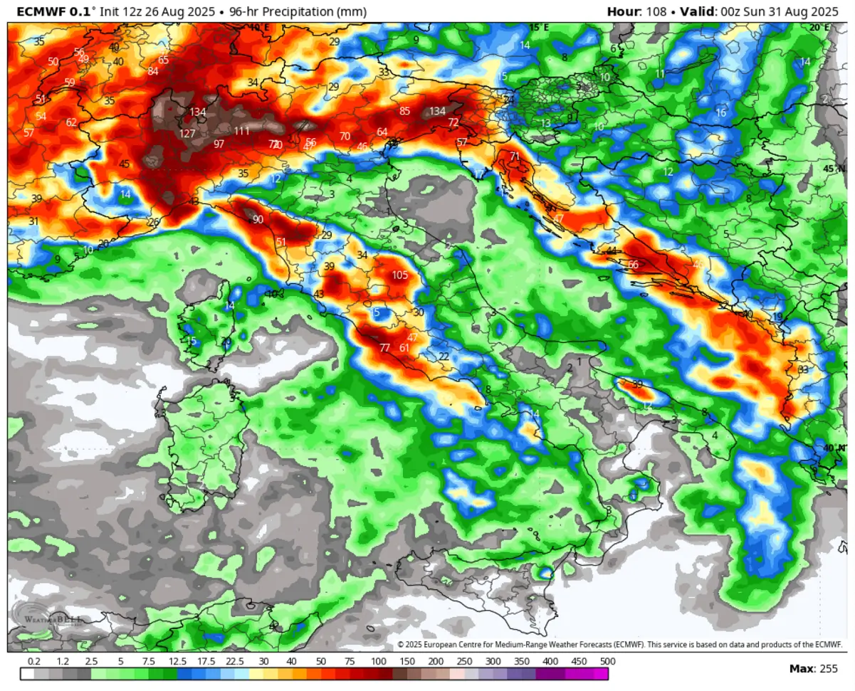

The weather models hint at intense orographic rain combined with severe thunderstorms, with training cells over the same areas resulting in high rainfall sums. Thus, they forecast even more than 300 mm of rain in some places along the complex terrain of the Alpine flank.
Those areas include the mountainous terrain of the Aosta Valley, Piedmont in northwestern Italy, northern Lombardy, and Friuli-Venezia Giulia. The northern Apennines in the Liguria region will also see high rainfall and likely severe thunderstorms with intense rain, flash floods, and waterspouts along the coastal areas from Liguria to Tuscany.

Once the frontal system ejects further east-southeast late Friday, the activity shifts to the southeast Adriatic, with high rainfall and severe thunderstorms on Saturday.
While there will be a short-term pause after this front until Monday, the mid-range trends already suggest another deep trough with similar rainfall amounts is predicted for the northern Mediterranean again mid-next week.
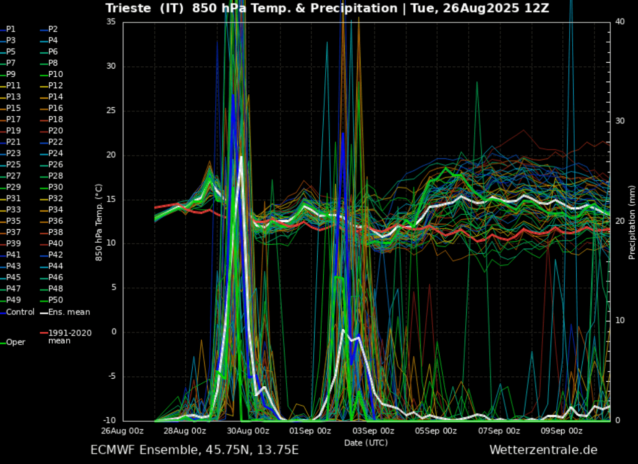

Recap: There is a high risk potential for widespread intense rainfall and severe weather over the next 3 days. We will issue a detailed severe weather outlook for the northern Mediterranean in the follow-up article tonight – stay tuned.
Windy, Wxcharts, and WeatherBell provided images used in this article.
See also:
Source link
#deep #trough #Europe #prompts #severe #weather #outbreak #meteorological #summer #Severe #Weather #Europe
