[ad_1]
Unsettled weather conditions are forecast across western Europe, the UK, and Ireland over the next few days as remnants of Hurricane Erin are set to impact Europe this week. After peaking at Category 5 strength, Erin traveled east of North America and turned towards Europe as an intense post-tropical cyclone. The system raises concerns for a potential severe weather outbreak late this week.
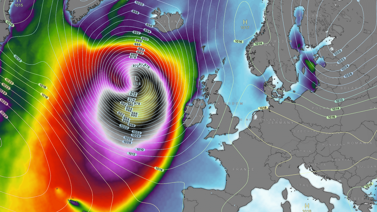
Remnants of hurricane Erin will remain intense through Monday and Tuesday, centered west of Ireland and the UK. Ahead of Erin’s impact, the UK could hit 30 °C on bank holiday Monday before the rain starts. High waves will impact the western shores.


The warm weather will only be short-lived on Monday. Overnight into Tuesday, the remnants of Hurricane Erin are forecast to initially bring wetter and windier conditions to Ireland, Northern Ireland, and then across most of the UK.
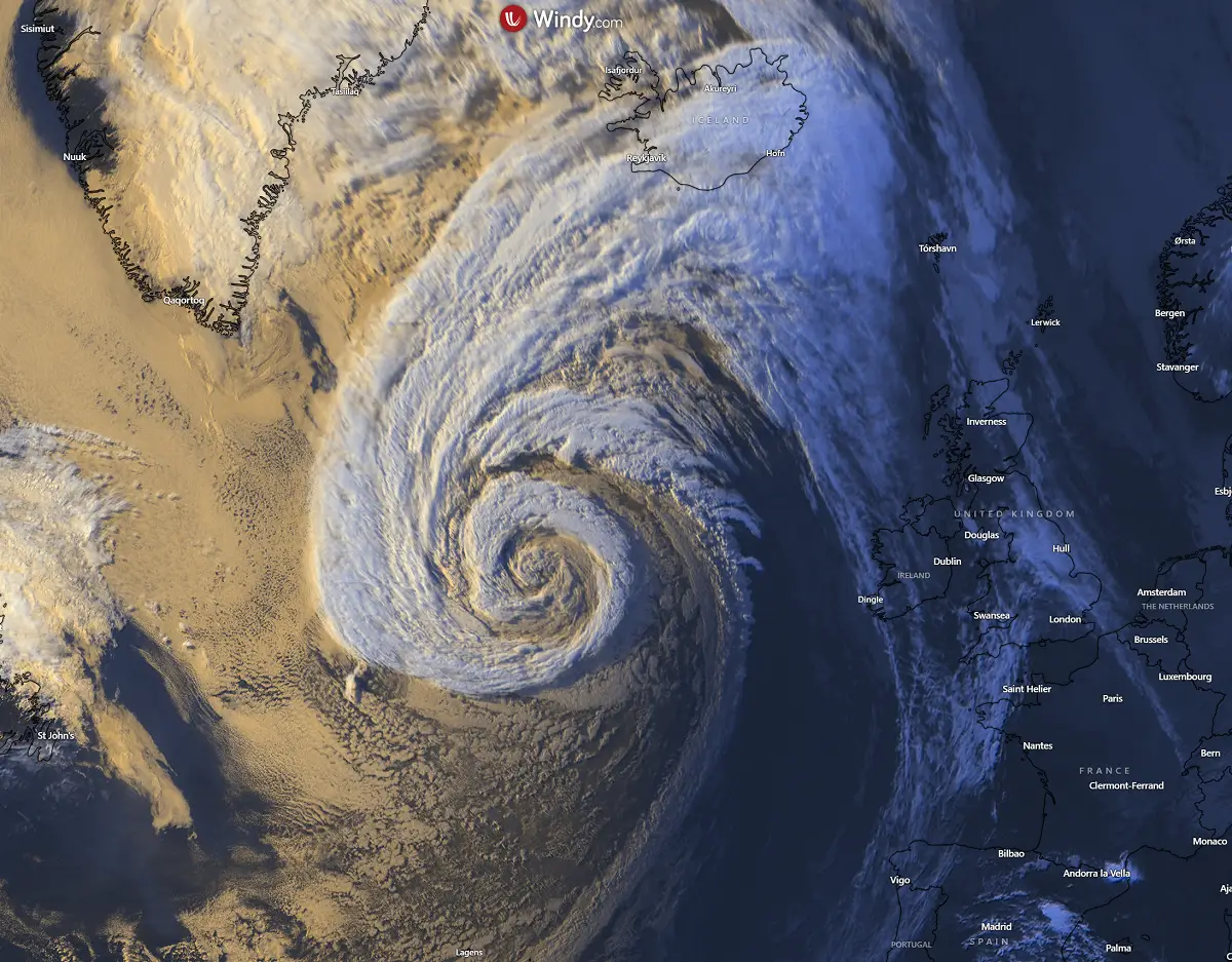
On Sunday, Erin, now acting as an intense post-tropical cyclone, was located west of Ireland and southwest of Iceland in the North Atlantic. Satellite imagery revealed its impressive cyclonic structure around the core.

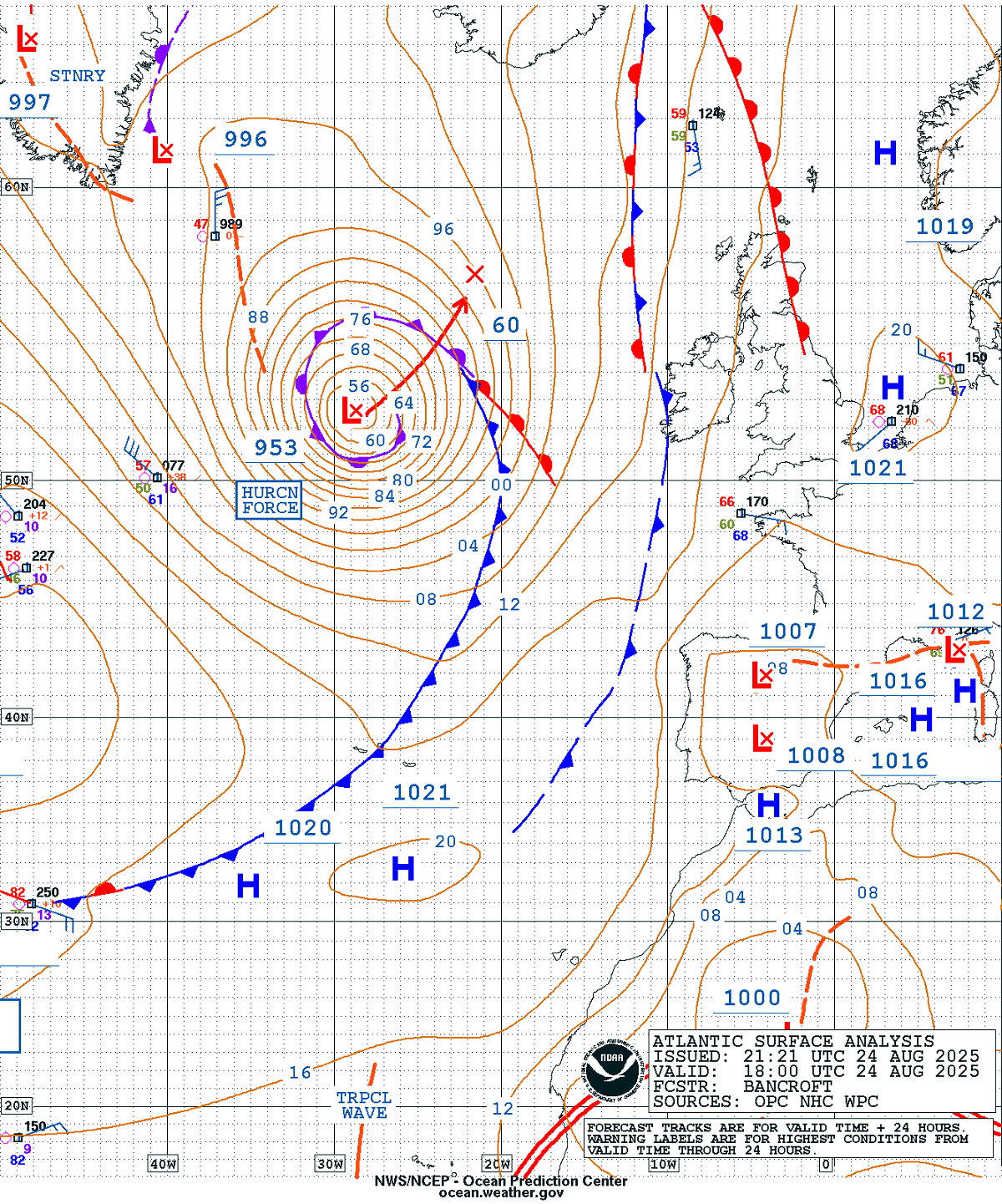
NOAA Ocean Prediction Center (OPC) analysis revealed that ex-Erin still supported hurricane-force winds, with the central pressure estimated at around 953 mbar by 18 UTC.
The system will remain intense and well-organized through Monday into early Tuesday as it main front impacts Ireland and the UK.

Before we discuss the storm’s evolution in further detail, let’s examine the wind, temperature, and precipitation forecast for the European continent this week. Remnants of Erin will support a deep trough/low over the North Atlantic for another three days.
Then, the wave gradually moves into western Europe and digs further south-southeast, introducing severe-weather potential for the northern Mediterranean region late this week.
Europe is set to encounter more dynamic weather for the remainder of August, which will likely extend into early September.
Hurricane Erin’s path – the first Category 5 storm of the Atlantic season 2025
Erin was the first storm to attain hurricane strength this Atlantic season, 2025. It started as a tropical wave on August 9th, traveling west across the central Atlantic, and rapidly intensified into a Category 4 storm on August 16th.
Soon after, NOAA Air Force Hurricane Hunters reported that Erin strengthened to a Category 5 hurricane, with maximum sustained winds of 160 mph (260 km/h) and a minimum central pressure of 915 mbar. Erin held this intensity for much of the day until the storm commenced an eyewall replacement cycle and began weakening.
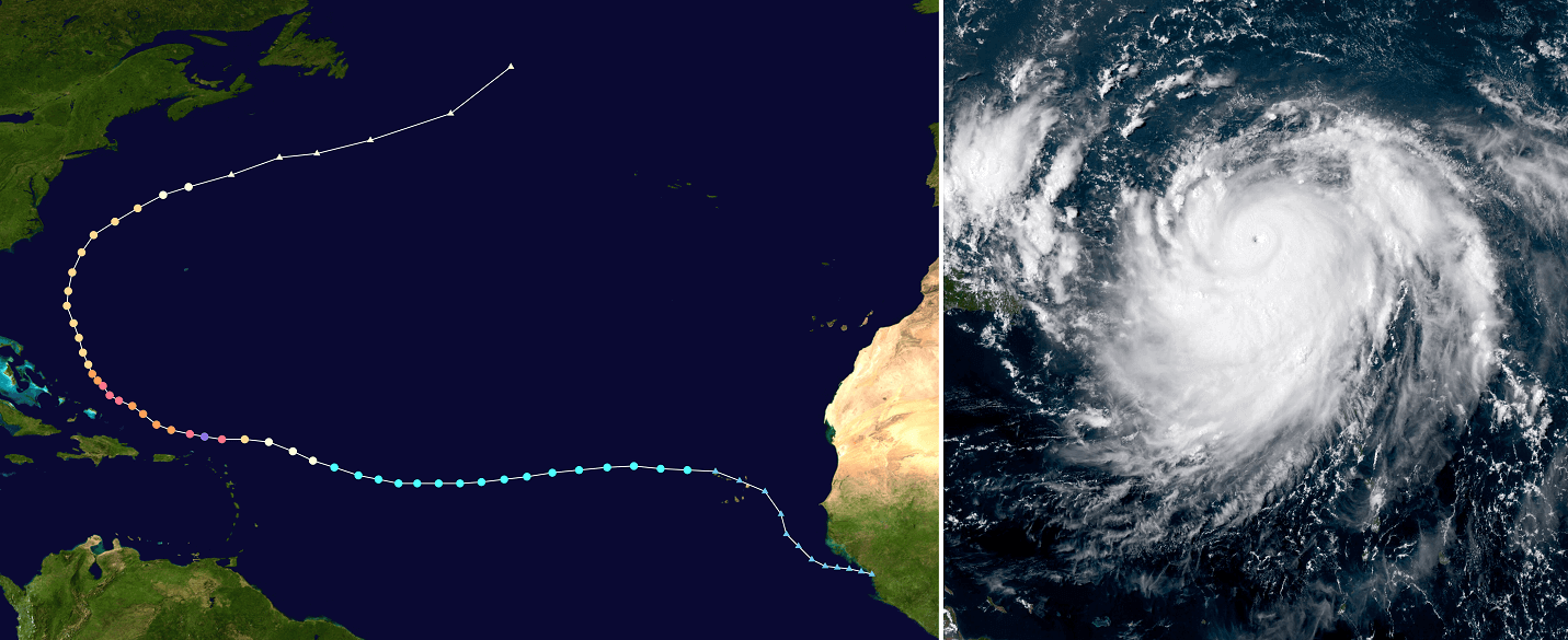

Hurricane Erin, which skirted the Caribbean and east coast of the US this week, has also helped push warm, tropical air towards western Europe, spreading into Ireland and the UK this weekend.
The system will maintain its hurricane-force winds strength on Monday, while from midweek onwards, things turn more widely unsettled, with strong winds and some heavy, thundery downpours at times. Rainfall and windy conditions are expected to persist throughout the rest of the week.
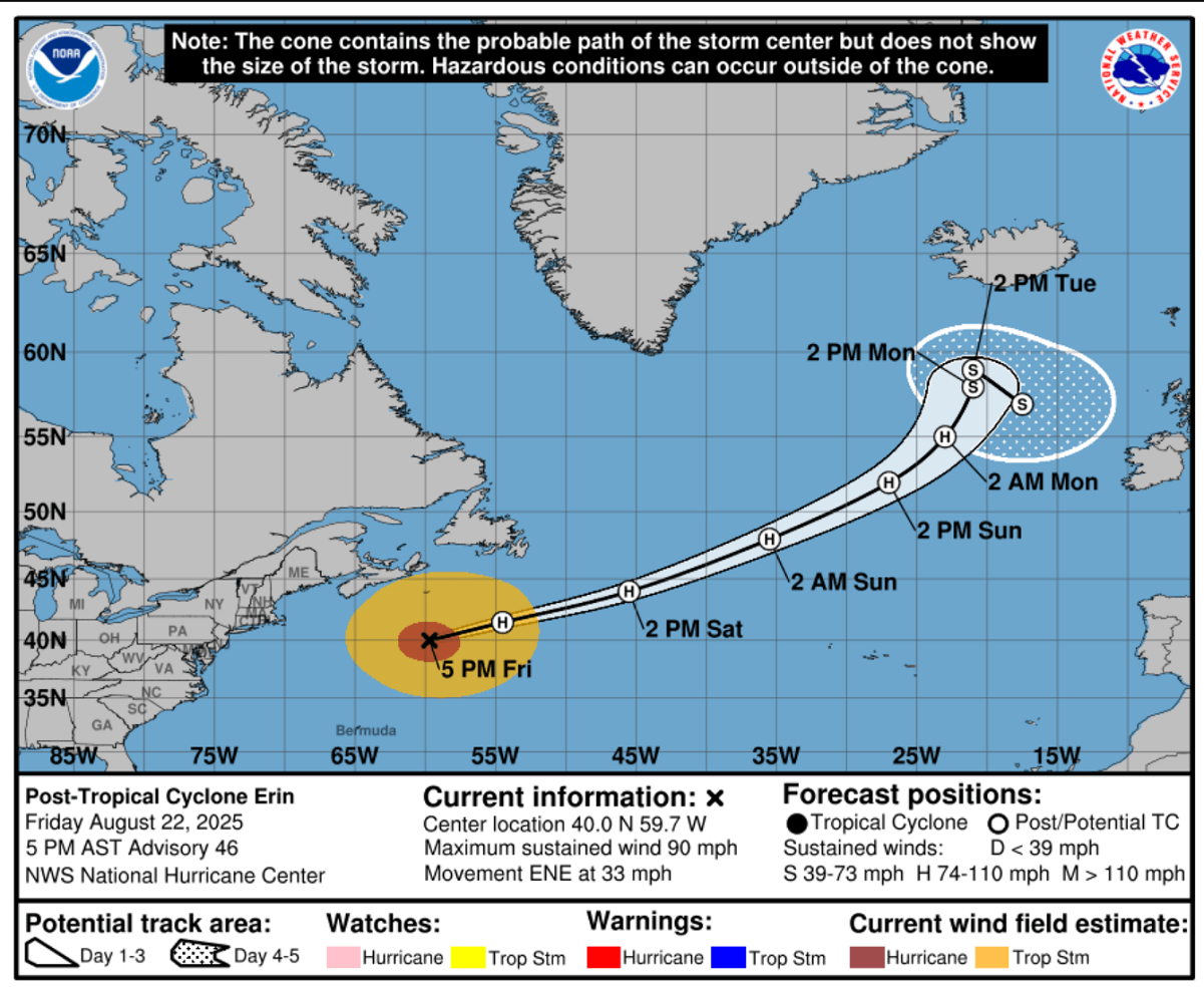

However, Ex-Erin will remain intense until Tuesday before the cyclone matures and gradually shifts east-south across western Europe. After mid-week, it will emerge deeper into the continent.
Deep North Atlantic wave/low will impact Ireland and the UK with high waves
On Monday, the weather pattern over Europe reveals a deep low west of Ireland, associated with the remnants of hurricane Erin, which arrived from the northwestern Atlantic. A short-lived ridge develops ahead of the low, bringing warm bank holiday weather for the UK. Another deep, large-scale wave remains over the eastern half of Europe and western Russia.
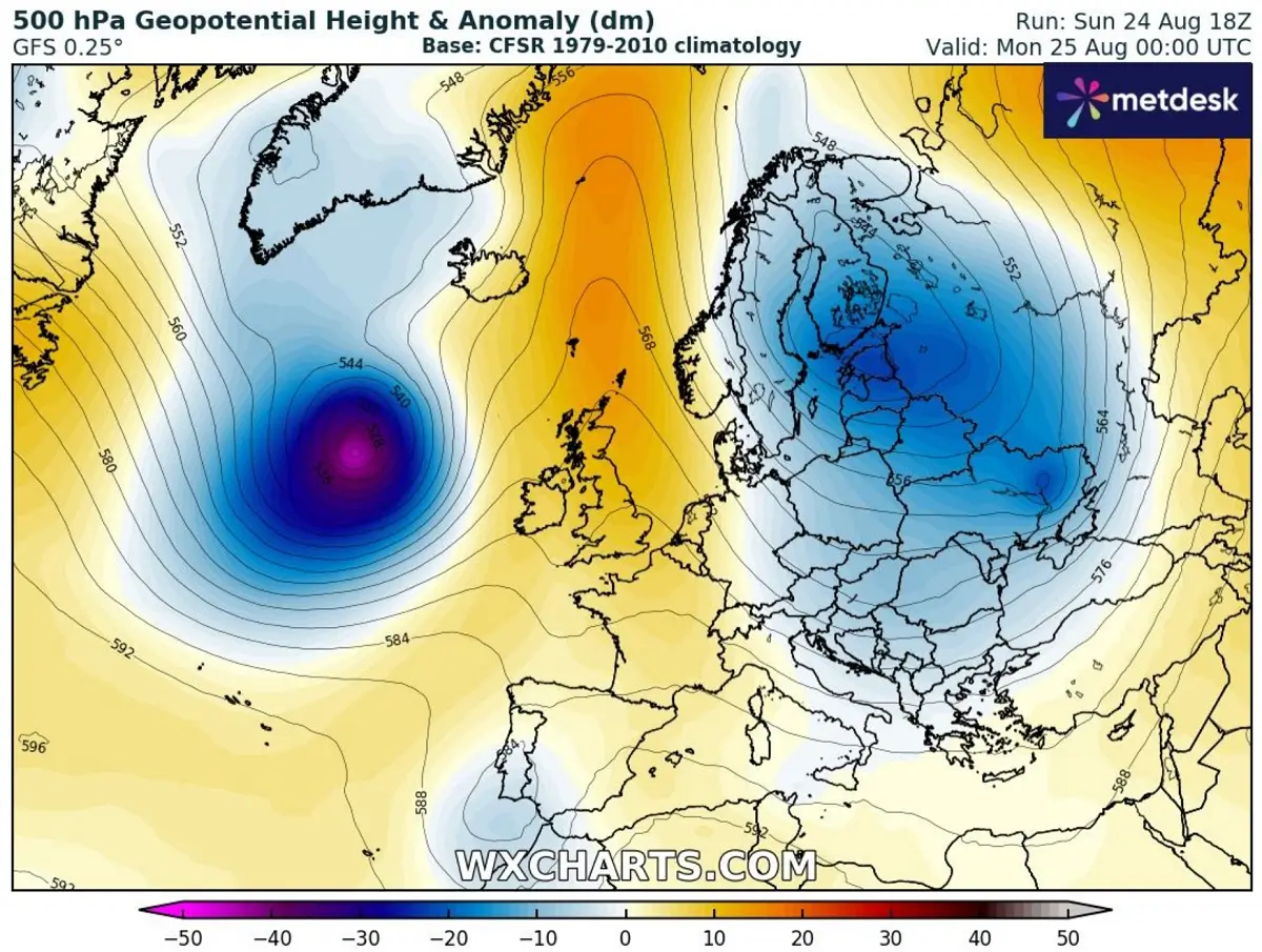

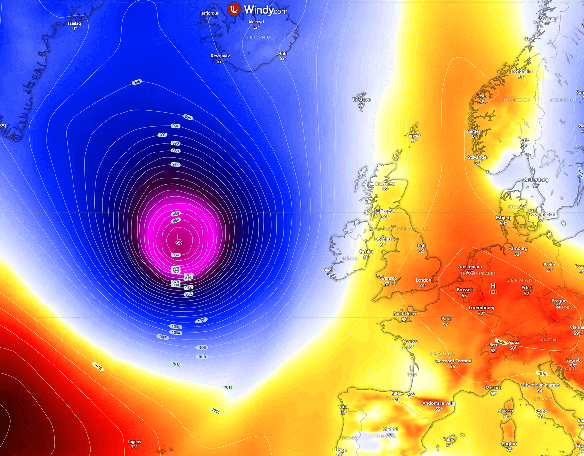
A deep cyclone will maintain the central pressure around 960 mbar at the surface, with a high-pressure area spread across continental Europe. This will support warm weather over the next two days before the Atlantic wave digs into the continent.
The lowest central pressure with the post-tropical cyclone is forecast to be on Monday. The system will gradually fill as it wobbles west of Ireland on Tuesday and turns into western Europe by Wednesday.

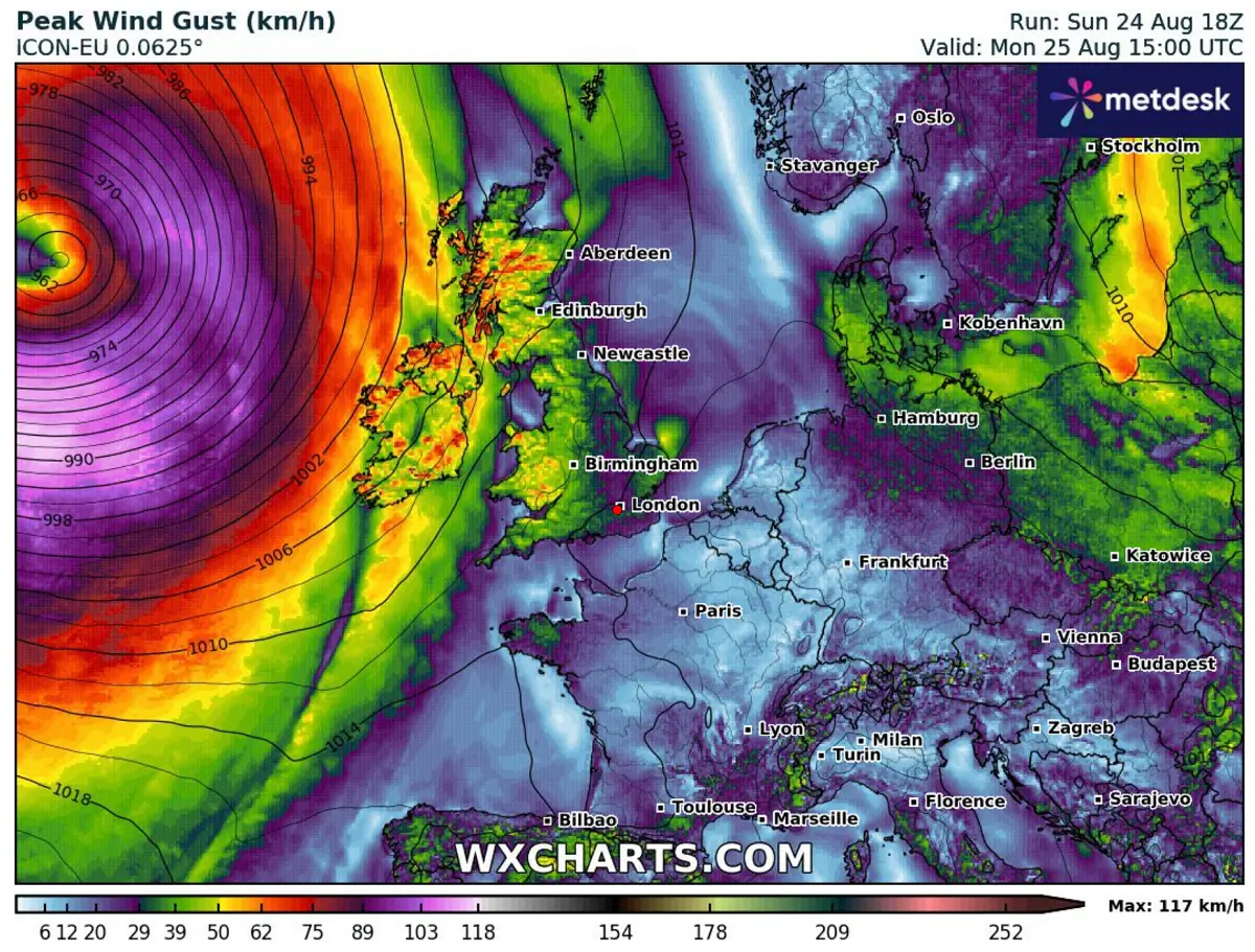
The wind field with the Atlantic low will be huge and remain intense on Monday. Note that the low has a tropical origin, which often means the air masses support more robust environments than the classic North Atlantic and mid-latitude lows.
Therefore, winds with Erin’s remnants will be intense on Monday, though staying mostly offshore to the west of Ireland, Northern Ireland, and Scotland.

However, significant wave heights are expected to persist due to the high pressure gradient and the large-scale cyclone.
On Monday, the highest waves will be 10-12 meters to the west of Ireland, gradually spreading east towards the western coasts Monday night into Tuesday.
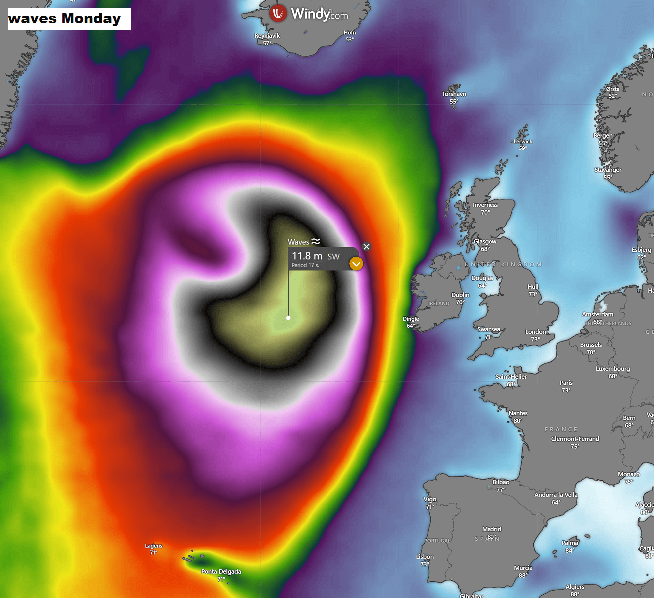

The system is extensive, as clearly seen by the area covered with significant wave heights.
The deep low moves into western Europe by mid-week, and unsettled conditions return
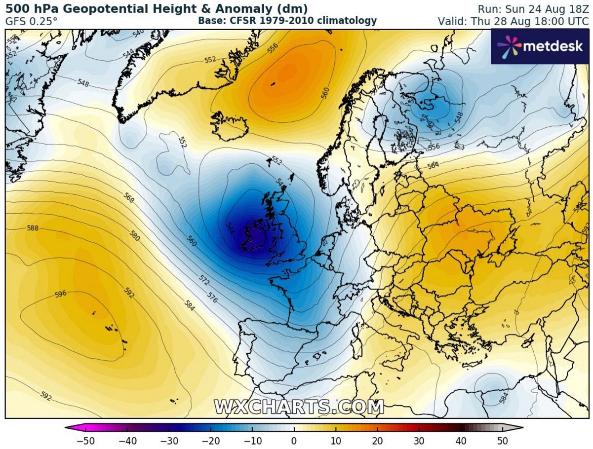
By Wednesday night, the deep upper wave and surface low turn towards western Europe, impacting Ireland and the UK the most on Thursday. The strengthening of the Azores ridge opens the corridor for the wave to continue traveling deeper into the European continent throughout the second half of the week.

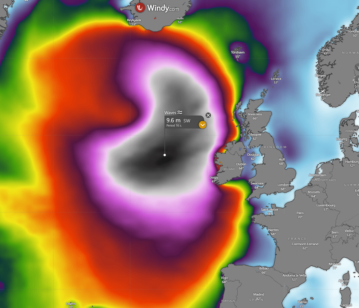
With the low emerging over western Europe, the high waves also push towards the coasts. On Wednesday and Thursday, the most significant wave heights are forecast to reach 8-10 meters along the western shores of Ireland, Northern Ireland, and the Outer Hebrides in Scotland.
High waves will also push across the Bay of Biscay towards western France, northern Spain, and southern Iceland.

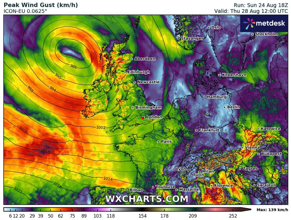
As the low gradually fills after its mature stage on Tuesday, the winds will not be particularly intense after mid-week.
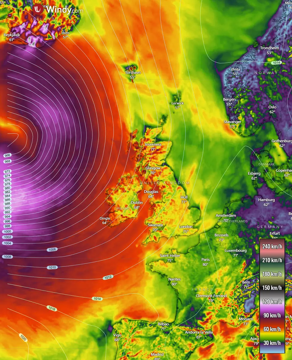
The highest gusts could reach 70-90 km/h in some areas, so that conditions will remain unsettled with rainy periods, but not extreme or severe.

Here are the overall wind gust accumulations associated with the ex-hurricane Erin’s impact on western Europe. As the most intense stage of the low remains west of Ireland and the UK, so will the most severe winds.
The only area that should experience severe winds with ex-Erin will be southern Iceland, on the northern skirts of the large Atlantic low.

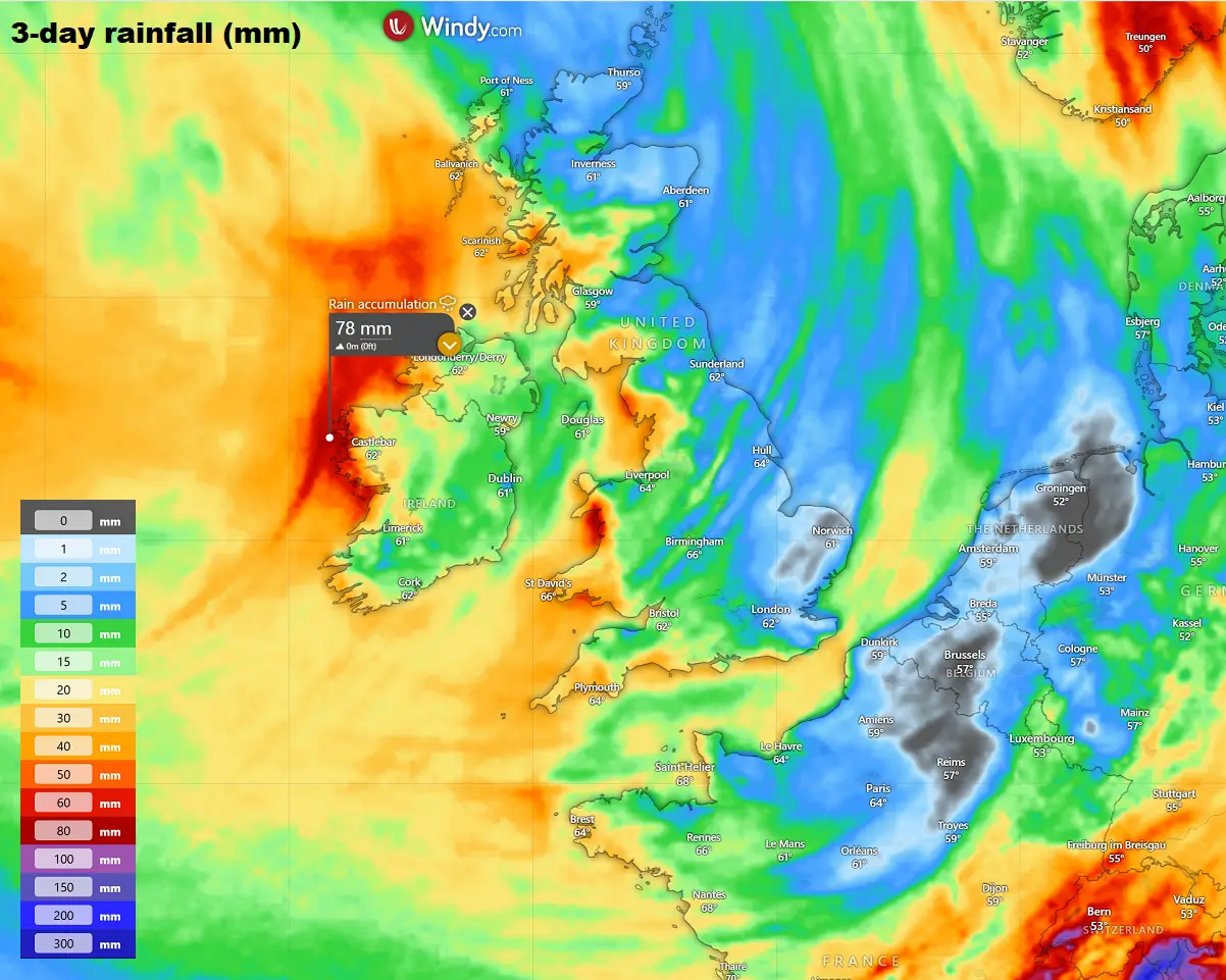
The highest rainfall is forecast for the western shores of Ireland, Northern Ireland, and west Scotland, with the Hebrides. There, 50-80 mm of rainfall will likely accumulate from Monday through Wednesday.
Elsewhere, a good amount of rain is also forecast over Wales, northern UK, and southwestern UK.

One thing to note about the deep wave emerging into Western Europe is its potentially significant impact for the remainder of the week. What is becoming concerning is the amplification of the upper-level jet stream, which will dig south around the deep wave. As discussed earlier, the system also has a tropical air mass origin.
This means that powerful winds in the higher levels will spread across France towards the northern Mediterranean and the Alpine region. The region remains in warm late-summer conditions, followed by the historic warmth of the Mediterranean Sea.
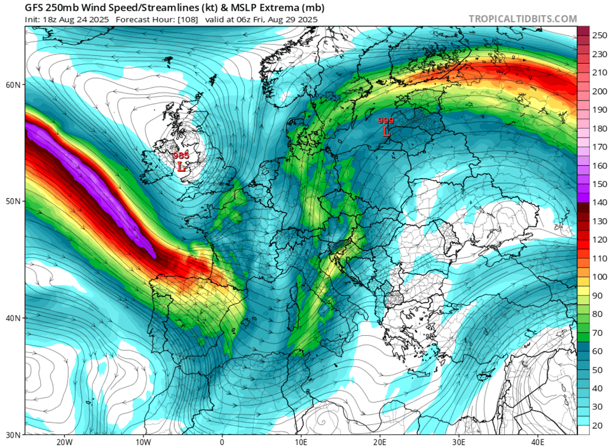

This hints at a potentially multi-day severe weather outbreak for the region starting late Wednesday through Saturday, as the intense jet stream and volatile air mass combine over the area.
We are closely monitoring the pattern’s evolution in the coming days and will update the forecast accordingly. Stay tuned for a high risk potential for widespread intense rainfall and severe weather.
Windy, Wxcharts, and OPC provided images for use in this article.
See also:
Hurricane Erin – the first Category 5 of the Atlantic Season 2025
[ad_2]
Source link
#Exhurricane #Erins #impact #weather #Western #Europe
